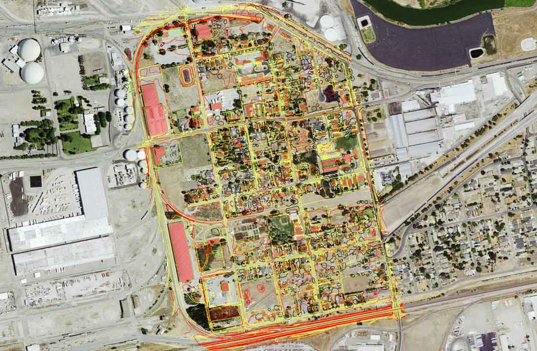
Kjeldsen, Sinnock & Neudeck, Inc. (KSN), under sub-consultant contract with Nolte Associates, prepared planning level aerial based topographic mapping for approximately 150 acres of the area bounded on the north by the Stockton Deepwater Channel, on the east by Pershing Avenue, on the south by the BNSF Railroad and on the west by the Stockton Public Belt Railroad. The mapping was prepared at a scale of 1 inch = 80 feet with two foot contour intervals. Spot elevations met or exceeded National Mapping Accuracy Standards of one half-foot accuracy. Mapping included visible planimetric features. All mapping was referenced to the California Coordinate System of 1983, Zone 3 and the National Geodetic Vertical Datum of 1929 (NGVD 1929).

