Kjeldsen, Sinnock & Neudeck, Inc. (KSN) is the leading firm involved in Flood Emergency Response Planning in Northern California. KSN has developed and established regional standards for Northern California for: Emergency Operations Plans, GIS-Based Maps, Preliminary Engineering Designs, and Just-in-Time Training.
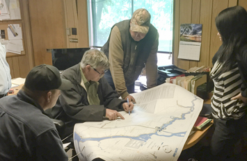
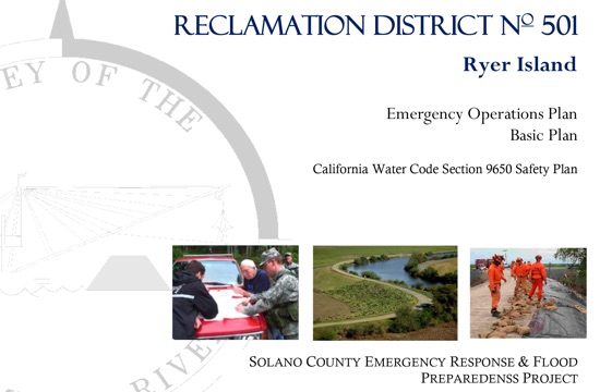
KSN prepares AB-156 compliant Emergency Operations Plans – Basic Plan in close partnership with Levee Maintaining Agency (LMA) representatives from Project Areas. The plans follow guidelines provided in FEMA’s Comprehensive Preparedness Guide (CPG)101 and California Water Code 9650. The plans assist LMAs to better prepositioning themselves to receive disaster reimbursement, by carefully documenting their flood preparedness and response procedures.
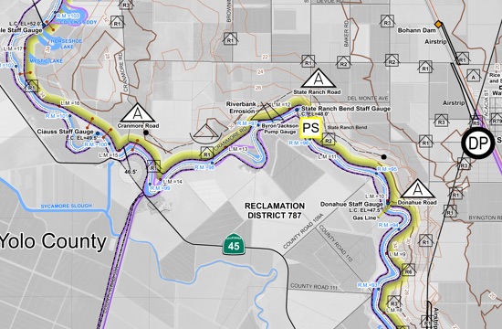
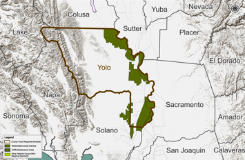
GIS-Based Maps are created to supplement Emergency Operations Plans as a practical visual aid during emergency flood operations. KSN has developed standardized symbology across the Central Valley, designed to be simple, eye-catching, and useful during an event. The maps are familiar and identifiable across neighboring counties, increasing response efficiency across jurisdictional lines. All maps are designed to be fully editable in an efficient manner during an emergency by GIS-users.
Flood Contingency Maps (FCM)
FCMs are local maps used by Levee Maintaining Agencies to aid their flood fight operations. These maps display flood contingency options, known levee problem areas, and areas important for logistical planning such as supply staging areas and patrol sectors.
Unified Command Maps (UC)
UCs are maps used at a broader level, such as county EOC, in order to facilitate communication and coordination across jurisdictional lines, amongst Levee Maintaining Agencies, Counties, and Public Safety agencies.
Special Case Maps
Special Case Maps are a combination of flood contingencies and evacuation maps for small populated areas, such as rural communities.
Public Safety Maps (PSM)
PSMs are created for County use to facilitate evacuation operations in critically populated areas.
Citizen Maps
Citizen Maps convey important information using intuitive symbology that citizens can interpret in order to efficiently and safely evacuate from an area in a flood event.
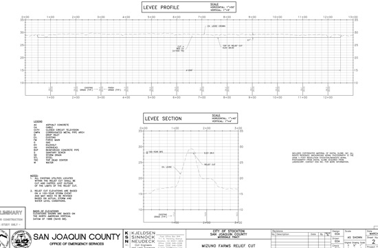
In tandem with developing Flood Safety Plans for Levee Maintaining Agencies, Preliminary Engineering Designs (PED) were created to complement flood contingency options and provide professional engineering background for substantial emergency projects such as relief cuts. KSN prepared technical memos and exhibits that guide the implementation of contingency options including emergency berms and relief cuts.

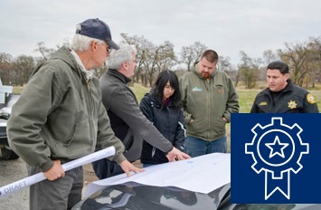
The Just-in-Time Training website is being developed as part of the Mid-Upper Sacramento River Emergency Response Project. KSN is the creator of the new online training program that provides practical, efficient courses that could be accessed by Emergency Levee Workers shortly before a flood event. KSN prepared and organized content and material condensing long classes into short videos providing basic training critical for flood-fighting. Content includes introduction to flood fighting, monitoring and marking levee issues per DWR guidelines, SEMS/NIMS organization and structure, and how to address datum conversions.