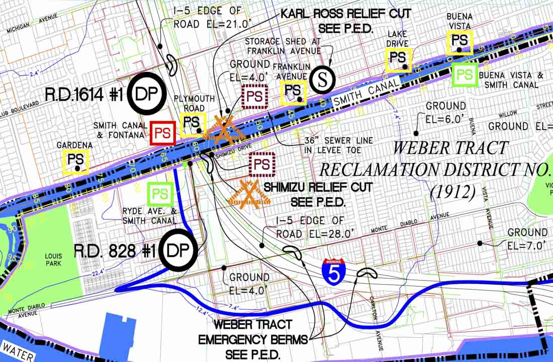
Kjeldsen, Sinnock & Neudeck, Inc., (KSN) contracted with San Joaquin County Office of Emergency Services to provide civil engineering, surveying, and mapping services for the San Joaquin County Flood Contingency Mapping FEMA Pilot Project. KSN performed in-depth historical data research at several State, County, City, and local agencies and departments. KSN coordinated and prepared required access permit packages for survey access within the mapping areas, performed field surveys and processed field data for approximately 62 square miles. KSN collaborated on the development of the standards and procedures used in the preparation of detailed flood contingency mapping and prepared maps for Smith/Weber Tract, Roberts Island, Boggs Tract, and Mossdale Landing Reclamation Districts. KSN also compiled information for development of the Flood Contingency Map Technical Manual, “Guide to Flood Contingency Mapping”. The “Guide” encompasses the standards and procedures created through this Project including the standardization of topographic, historical, and emergency response Map Data Elements; and the development of easily recognized and readable Map Symbols. The Flood Contingency Mapping Program was presented to Brigadier General Donahue of the US Army Corp of Engineers August 16, 2010. General Donahue has since implemented the program by issuing a $1 million contract to develop Flood Contingency Mapping for other Counties within the Sacramento and San Joaquin Delta Area.

